US 287

US 287

About US 287

Commuting Solutions played a key role in the Northwest Area Mobility Study (NAMS), which identified US 287 as one of six priority corridors for future transportation and mobility investments.

US 287 is a major north–south highway paralleling I-25 and connecting Longmont, Lafayette, and Erie, as well as Boulder County to Larimer, Broomfield, and Denver Counties. It also serves as a key freight route supporting the regional economy.

Despite its importance, US 287 has the highest number of fatal crashes in Boulder County and is largely part of Denver Regional Council of Governments (DRCOG) Vision Zero [PDF] high-injury network.

Current planning efforts aim to improve multimodal travel — including potential Bus Rapid Transit (BRT) — to ensure the corridor serves all users safely and efficiently.

US 287 Coalition​

The US 287 Coalition brings together staff and elected officials from local governments, MPOs, RTD, CDOT, and the FTA.

Its purpose is to provide a forum for inter-regional planning and collaboration to address growing travel demand and safety needs along the US 287 corridor linking Boulder, Broomfield, and Larimer counties.

The Coalition’s goal is to elevate the corridor’s importance and accelerate improvements. Commuting Solutions facilitates and coordinates the group on behalf of Boulder County.

Image of commuter exiting an RTD bus

US 287 Vision Zero Safety & Mobility Study

US 287 Vision Zero Safety Study Area along 287 from Broomfield to just north of Highway 66

The US 287 Vision Zero Safety and Mobility Study [PDF], completed in December 2023, is a collaborative effort to eliminate traffic fatalities and serious injuries while improving multimodal transportation along the US 287 corridor from Midway Boulevard in Broomfield to the Boulder/Larimer County line.

This study was led by Boulder County in partnership with the Colorado Department of Transportation (CDOT), City of Longmont, Town of Erie, City of Lafayette, City and County of Broomfield, Denver Regional Council of Governments (DRCOG), Regional Transportation District (RTD), Commuting Solutions, and community members

Key elements of the study include:

  • Comprehensive Crash Analysis: Identifying trends and providing targeted recommendations aimed at achieving zero traffic-related fatalities and serious injuries along the corridor.
  • Multimodal Mobility Assessment: Evaluating the feasibility of a new Walk-Bike Path alongside US 287 to improve accessibility and safety for pedestrians and cyclists.
  • Network Connectivity: Pinpointing gaps in the multimodal system and proposing strong linkages to future Bus Rapid Transit (BRT) stations as well as existing and planned key destinations.
  • Environmental Review: Conducting a planning-level environmental analysis to understand context and potential constraints for future project phases.

US 287 Bus Rapid Transit (BRT) Feasibility Study

In April 2022, Boulder County and its partners completed the 18-month US 287 Bus Rapid Transit (BRT) Feasibility Study, which explored transit improvements to better serve growing communities and major destinations, with BRT as a core element.

Extensive community engagement shaped the study’s recommendations and phased approach to regional transit upgrades. Public feedback consistently emphasized that, alongside better transit, safety for all users along and across US 287 is a top priority.

Study Outcomes:

  • Recommendations for the type and location of capital investments that will enhance travel times on US 287.
  • Assessment and analysis of traffic patterns, current transit operations and facilities, vehicle queue lengths and intersection treatments
  • Creation of a Station Areas Toolkit [PDF] [PDF] to serve as a convenient resource for BRT station design
  • Identification of potential funding sources
  • Framework for implementation of BRT along US 36

Additional NAMS Corridors

An overhead view of 120th Avenue in Broomfield looking northeast

120th Avenue

120th Avenue is an important regional corridor that has been identified for multimodal improvements in various plans and studies.
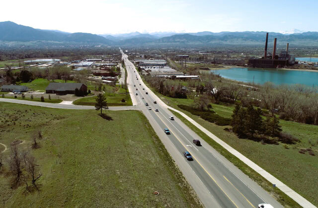
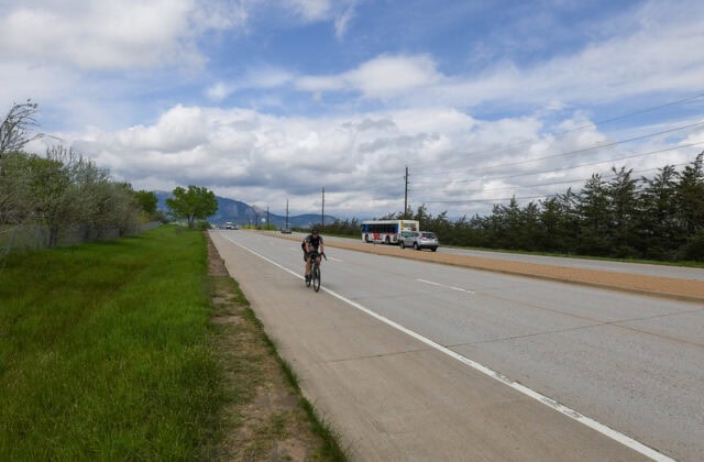
Cars drive west on CO 119, the Diagonal Highway

CO Highway 119

Construction is underway on the CO 119 Safety, Mobility, and Bikeway Project, complemented by Boulder’s 28th Street Improvements and Longmont’s Coffman Street Busway—together advancing a shared commitment to safer, more accessible travel.

cyclists ride under a bridge with the Louisville sign in Louisville CO

CO Highway 42

The Cities of Lafayette and Louisville are working together to envision the future of State Highway 42 (also known as 95th Street, CO 42 or Courtesy Road) for people to walk, bike, ride transit or drive.
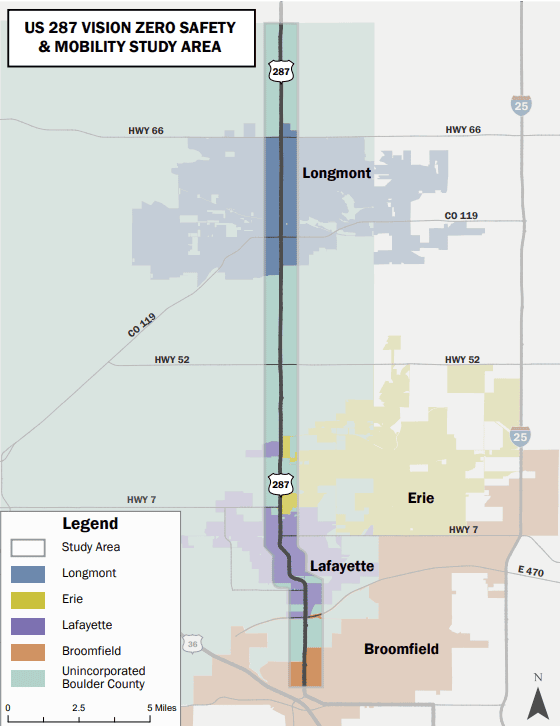
Aerial view of Colorado Highway 7

CO Highway 7

Commuting Solutions helped complete the Northwest Area Mobility Study (NAMS), which identified Colorado Highway 7 as a top priority for future transportation investment.

South Boulder Road

South Boulder Road

The South Boulder Road corridor is a critical east-west corridor in Boulder County, serving both regional and local connections between the three cities of Boulder, Louisville, and Lafayette. Through its 9.5-mile length from the intersection of Table Mesa Drive and Broadway in Boulder to the intersection of South Boulder Road and 120th Street in Lafayette, the corridor serves 50,000 residents and nearly 20,000 jobs within one mile.

Commuting Solutions uses Accessibility Checker to monitor our website's accessibility. Read our Accessibility Policy.